
Time: September 2022
Location: Pearl River Estuary, Guangdong-Hong Kong-Macao Greater Bay Area
Background
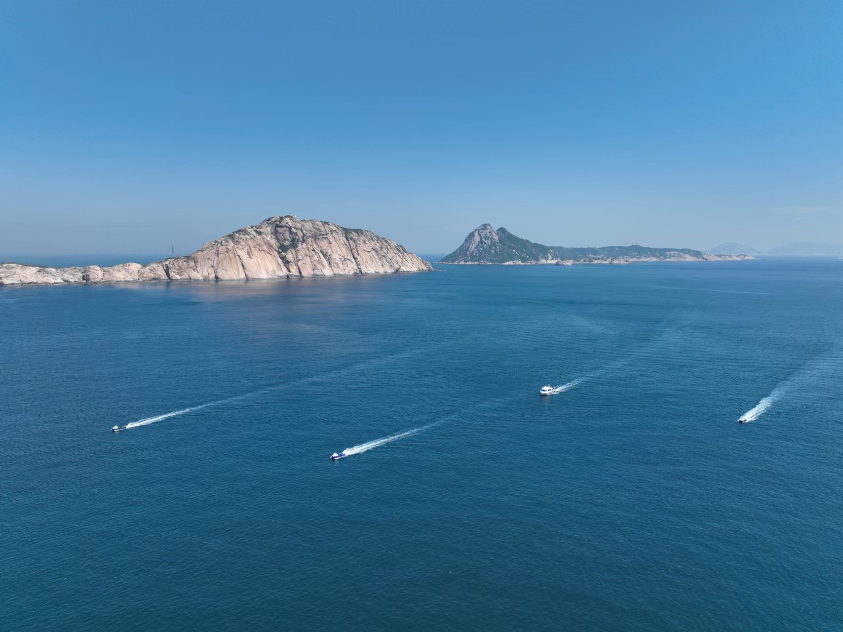
In September 2022, in the southwestern waters of Wanshan Island off the coast of the Greater Bay Area, the South China Sea Survey Technology Center, subordinate to the Ministry of Natural Resources of China, adopted a “1 mother ship + 5 unmanned vessels” approach to complete the first basic survey of the seabed in the offshore area of Wanshan West, deployed by the Guangdong Provincial Department of Natural Resources South China Sea Survey Project. The survey task was jointly undertaken by the South China Sea Survey Center of the Ministry of Natural Resources and several other units to conduct surveys of the topography of sea islands, offshore submarine pipeline verification, and offshore submarine sediment type surveys.
- The world’s first truly multiple USV cooperative seabed survey
- Currently the largest USV cooperative operation in the world
- The only USV surveying and mapping operation with a survey line of more than 30,000 kilometers in the world

Challenges
- The total workload of the project is 2,728 square kilometers, which needs to be completed within 80 days. Due to the short construction period and heavy tasks, coupled with frequent typhoons along the coast of Guangdong, the offshore operation window is very limited. It is necessary to organize the operation ships, survey equipment, and professional surveying and mapping personnel required for offshore surveys in a short period of time, and to ensure that the surveys are carried out within the specified time.
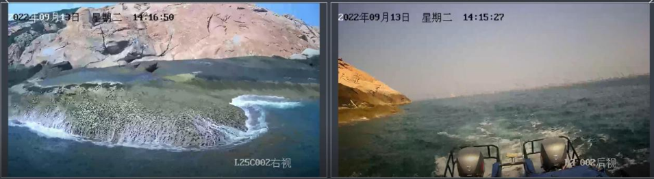
- There are many islands and reefs in the offshore waters, and it is difficult for ordinary operating vessels to approach, and there are great operational risks, which belong to the “difficult area” and “blind area” of surveying and mapping.
After the South China Sea Survey Technology Center’s research, they decided to try the innovative operation technology means of USVs, using USVs to cooperate in surveying and mapping and to conduct feasibility studies and application demonstrations of new technologies and methods for marine surveys.
Implementation Results
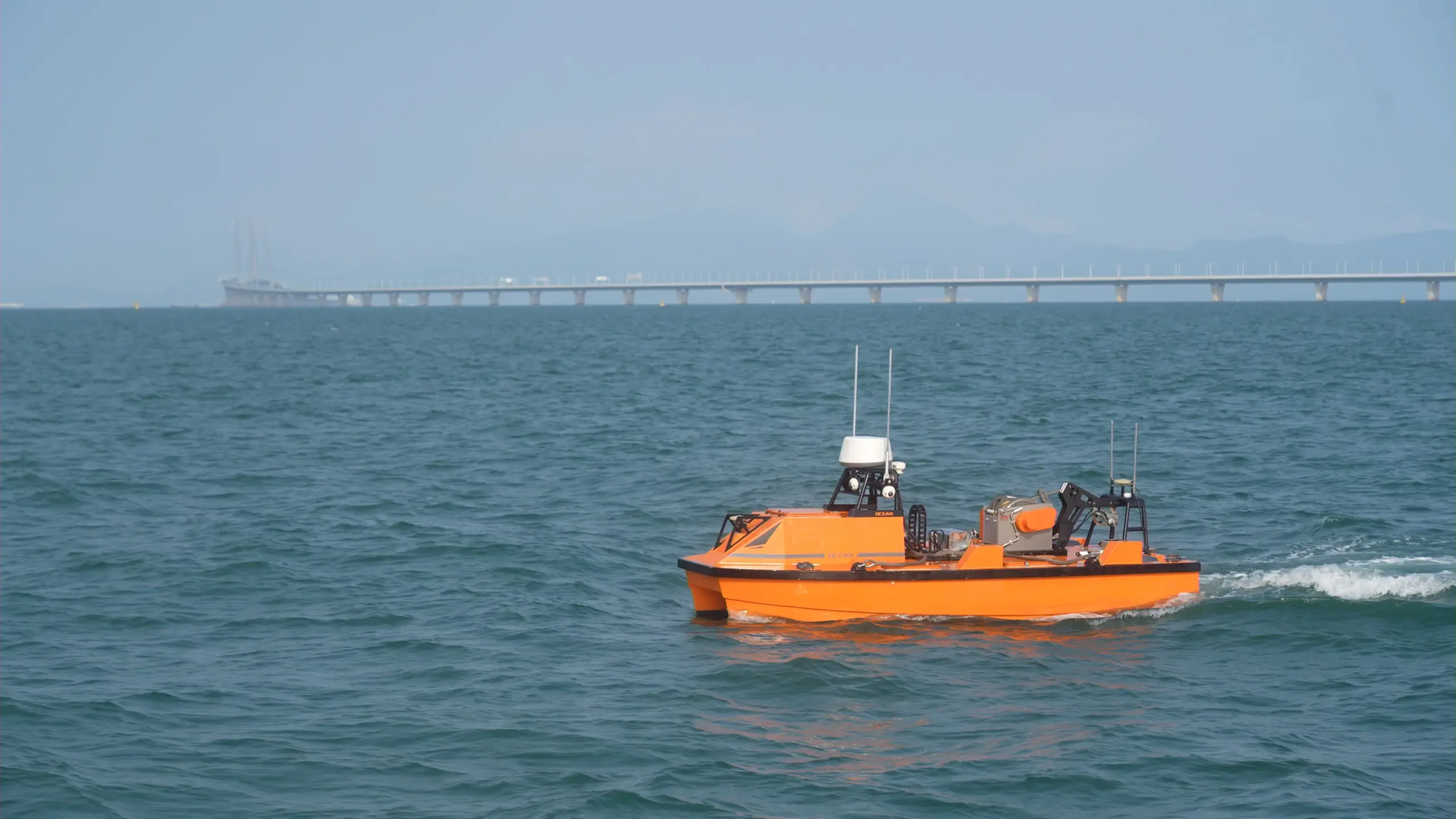
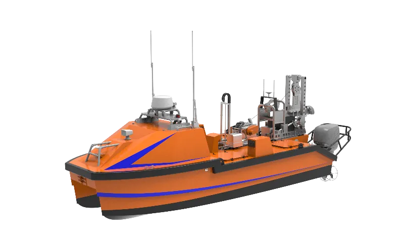
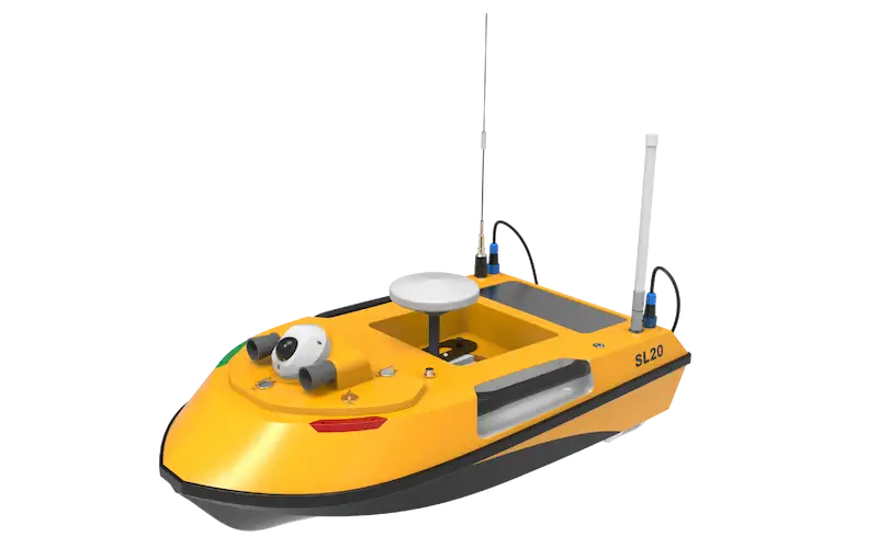
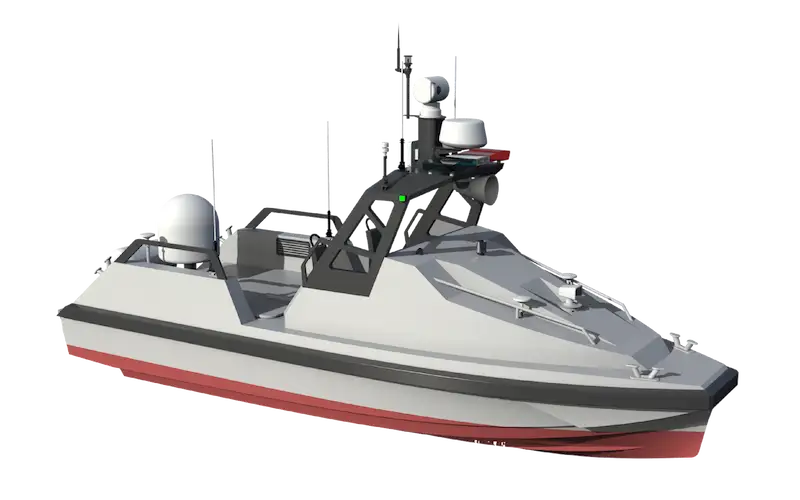
In this surveying and mapping mission, a total of five 7m L25C USVs were used. Its main technical parameters:
- Hull type: catamaran
- Hull size: 7.5m (L) × 2.8m (B) × 2.4m (D)
- Full load draft: 0.35m
- Empty weight: 2.3t
- Moon pool size: 0.5m × 0.6m
- Working speed: 5 – 6kn (still water)
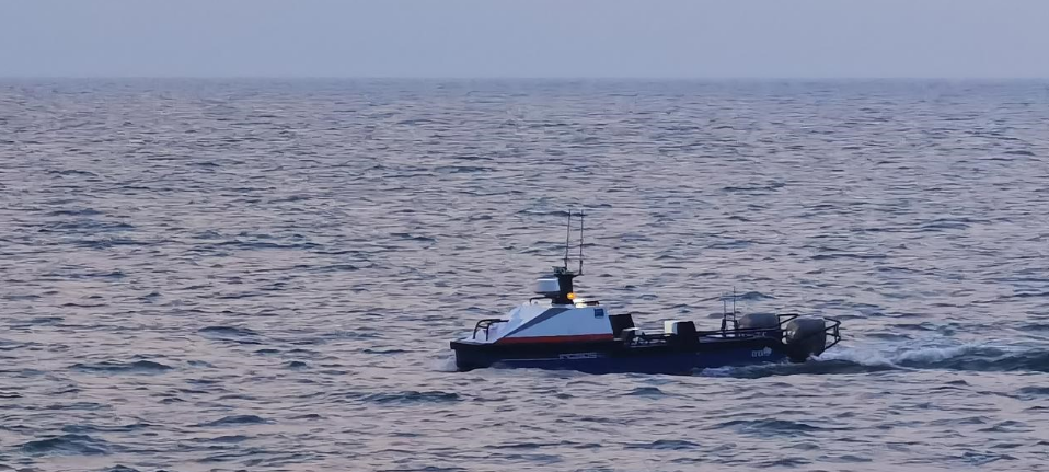
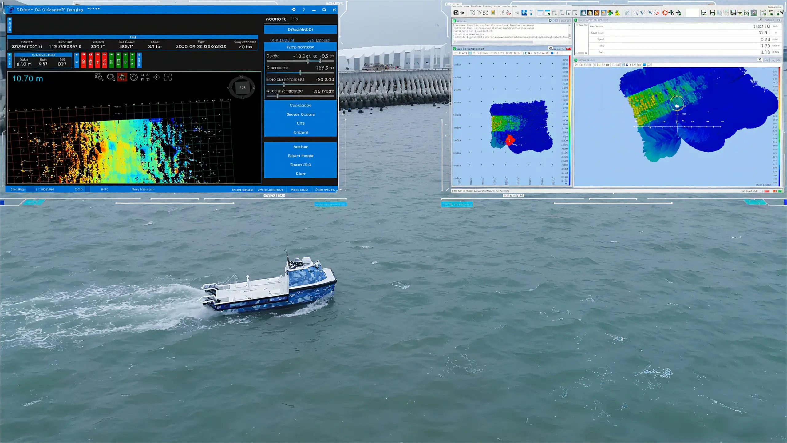
The task content is the hydrographic surveying and mapping of the shallow seabed. The USV is equipped with an automatic lifter equipped with a multi-beam echosounder, IMU, and sound velocity profiler. The dry-end is located in the equipment compartment at the front of the USV. The multi-beam transducer and the POS MV inertial measurement unit (IMU) are the wet-end parts, which are fixedly connected to the bracket through the transfer flange plate and the penetration screw.
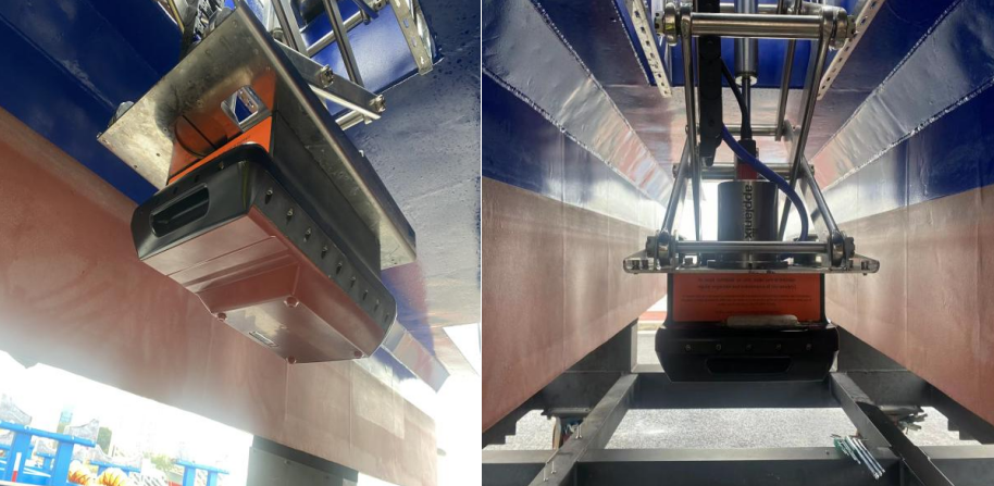
Multibeam installation
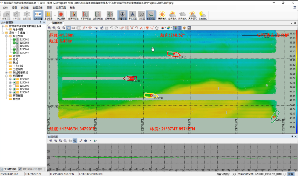
USV cooperative survey with multibeam data combination
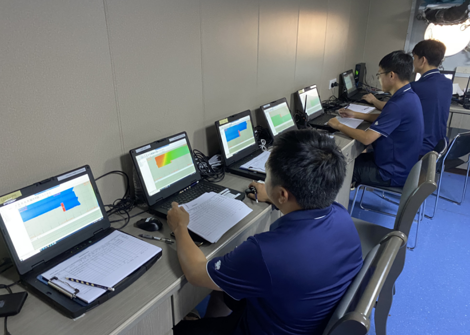
The L25C provides AC 220V, DC 12V, DC 24V, and other specifications of power supply for operating equipment. It is equipped with a high-performance reinforced industrial computer and multi-terminal data acquisition software to achieve cooperative mission arrangement, real-time data acquisition, and storage.
The USV cooperative control software remotely controls multiple USVs for mission setting and autonomous navigation. The control software has two operating modes: formation mode and area division mode. After preliminary testing, this project is more efficient using the area division mode. Therefore, when planning the mission, the general survey area is specially planned with multiple small survey zones, as shown in the figure below.
In each independent zone, the mother ship is at the center to ensure the longest communication distance of each unmanned vessel. The unmanned vessel navigates independently in each block step by step. After the regional measurement is completed, the overall transition to the next work blocks is made.
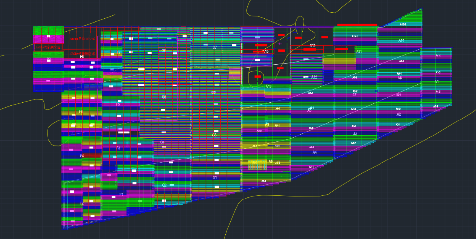
Survey zone scheme
In the end, the mission was completed, and the surveyed area was 2,728 square kilometers. The total mileage reaches 25,560 kilometers, which is equivalent to walking half a circle around the earth. The planned operation time was 80 days, and the actual operation time was 55 days. Tasks were completed in two-thirds of the allotted time, and overall operating costs were reduced by 30%.
Operation Advantage Analysis
The introduction of USV cooperative survey technology frees technical workers from simple and repetitive tasks. This innovative operation mode has the advantages of economy, efficiency, safety, accuracy, and easy replacement.
Economy: Compared with manned vessel operations, the more unmanned vessels are invested, the more economical the operation of unmanned vessels will be. According to the actual operation on site, the economic advantages of unmanned vessels are obvious. The specific analysis is shown in the figure below.
Efficiency: A mother ship equipped with multiple marine USVs can be regarded as a working team, and a manned survey vessel has a set of survey equipment. For urgent survey work, multiple vessels can also cooperate to operate 24 hours a day, make better use of the operation time window, and significantly improve the operation efficiency.
Safety: Taking this project as an example, the survey area includes 13 islands that have shallow water and submerged rocks. According to traditional methods, it is impossible to complete the survey of this “blind area”. With the advantage of a shallow draft of 40cm, the USV can conduct the survey and greatly guarantee the safety of operating personnel.
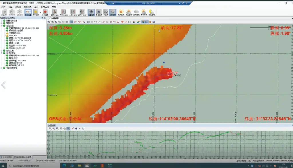
Survey results in shallow water area
Shallow water area operation
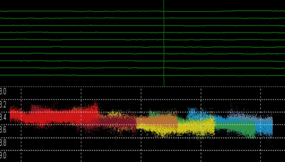
Survey line and edge data
Accuracy: It has been proved that the data accuracy of USV surveys is better than that of manned vessels. Because the hull’s hydrodynamic performance can be “tailor-made” for ocean surveys, the data collected by the multi-beam echosounder is more accurate. Compared with manned vessels, USVs have higher line-keeping capability (up to 1m), and the accuracy of matching edge data is also higher.
Easy payload replacement: Compared with manned vessels, USVs are equipped with various types of multi-beam echosounders, which are very simple and convenient to replace, while the installation of manned vessels requires a separate configuration of corresponding mounting brackets.
Customer Testimony
“It is the first time to use multiple USVs cooperative survey in offshore basic survey projects in China. The survey project acquired 2,728 square kilometers of offshore seabed topography data in the Greater Bay Area. The project implementation efficiency is high and the cost is greatly reduced,” said the project leader.
Conclusion
The introduction of USV cluster control technology has greatly reduced the labor intensity of people in marine surveying work, improved operational safety, and reduced operating costs, and the overall efficiency can be increased by dozens of times. This technology is especially suitable for the fast and accurate determination of large-area seabed mapping and other data in a short period of time. If 20 USVs are used to operate in groups, it will only take 30 to 300 days to complete the survey of the Strait of Hormuz and the Persian Gulf respectively. This provides a sharp tool for reducing costs and increasing efficiency for ocean surveying work.